
ALAMOSA — As the groundwater rules trial wraps up its first of what could be four weeks, witnesses are describing to presiding Chief District/Water Judge Pattie Swift the complexities of the San Luis Valley’s hydrology and the groundwater model developed to help the state enforce its proposed well rules.
On the stand on Thursday was engineer and groundwater modeler James Slattery who will conclude his testimony Friday morning before the court breaks for the week. Slattery explained methodology and procedures used in developing the Rio Grande Decision Support System (RGDSS), the groundwater model in its sixth phase that is used to determine how much water well users must replace to senior surface water rights. The model is crucial to enforcing the proposed groundwater regulations and is one of the issues in the trial.
The model covers 3,000 square miles in the San Luis Valley.
Slattery also described response functions that can be used for the same purpose as the model but take less time to run, are more easily modified and more user friendly. At the end of the day on Thursday he testified about how closely aligned the response functions were to the actual RGDSS model.
Slattery described for the court how modelers divided into sections or reaches the Valley’s various streams and rivers such as the Rio Grande, Conejos River and Alamosa River so they could be managed in sections that were sufficiently long enough to generate reliable results for the estimated depletions related to groundwater pumping for those stretches of the river. He testified that there were some stretches that would dry up, not have a live stream, but those were not always at the same place, which made management even more difficult. For example, he said Saguache Creek was difficult to model because it had different dry up points.
Other creeks, such as La Garita and Carnero Creeks, were shown in the model but not included in the response functions because “we never had a depletion to those streams,” Slattery explained.
“If there was no impact and the number was zero, we would not develop response functions,” he said.
The benchmark modelers used to decide what streams they needed to develop response functions for were the average depletions from 2001-2010 on various rivers and streams. For example, the average annual depletions from groundwater withdrawals on the Rio Grande from Del Norte to the Excelsior were 2,963 acre feet.
Slattery also talked about the importance of sufficient data to make the model work properly. He referred to Darcy’s Law, for example, which is a basic formula used in groundwater engineering. If sufficient information is available to plug into the formula, a solution can be reached, but if information is lacking, “you can’t really solve this equation,” he said.
When asked specifically about Diamond Springs (also known as Arroya Springs), a contested area in this trial, Slattery said that was one of the areas where Darcy’s Law could not be applied because there was insufficient data.
“We don’t have any perimeters to do that,” he said.
Slattery testified that there were few observation wells, if any, in the unconfined and confined aquifers throughout the Valley to calibrate the groundwater model from 1935 to 1970. It was not until the 1980’s, he said, before sufficient data was available from observation wells.
“After 2000 there was a concerted effort on water users and administration officials in the basin to try to collect more data so we would have more data to use in the groundwater model,” Slattery said.
Attorney Bill Paddock asked if Slattery could calibrate a groundwater model without groundwater data, and he said, “not only I couldn’t but no one can do that. It’s impossible to do that because you don’t have the data to calibrate the model.”
Slattery said 1988 was a threshold year for the modelers because at that point the basin had experienced some wet years and the aquifer system was close to full so “1988 is kind of like a start over point in the groundwater model.”
Slattery described the water balance or budget in the model, the groundwater inflows and outflows that “balance” the budget, and the various pieces that comprise each. For example, inflows include irrigation return flows, precipitation and rim inflows, while outflows include groundwater pumping and absorption from alfalfa sub irrigation, meadow sub irrigation and native vegetation, with those last three accounting for about 40 percent of the outflows in the basin.
“That’s a really unique feature in the San Luis Valley. That’s a very large component for the outflows for the Valley,” Slattery said.
During the time period of 1990-1998, the water budget Valley-wide showed 1,321,200 acre feet in inflows and 1,306,400 acre feet in outflows. Although well meters were not yet in place at that time, groundwater pumping was estimated to comprise 561,400 acre feet or 43 percent of that 1.3 million acre-foot outflow total. As a result of well measurement rules and meters being placed on wells, the current number for outflow due to groundwater pumping can be more certain, Slattery said.
He said that was an example “of how we try to improve the tools we have to evaluate the water resources in the San Luis valley. We try to measure things if we can.”
Slattery also described the water budget for the Conejos response area during that same time period when inflows were 198,300 acre feet and outflows 194,900 acre feet. That area illustrated many of the same characteristics as the Valley as a whole except that groundwater pumping only accounted for 22,200 acre feet or 11 percent of the outflows, according to Slattery who described Conejos geohydrology as “quite unique.”
The hydrology in the entire basin is unique and complicated, Slattery explained. He said, for example, that the San Luis Valley’s aquifer system is not a linear or straightforward system where the sum of the parts equals the whole. If it were, it would be much easier to determine depletions. In a linear system, he explained, “When you pump your well, 100 percent of the well depletions hit the stream. In the San Luis Valley, only a small portion impact the stream. A large portion is native vegetation.”
The sum of the parts does not equal the whole in a non-linear system like the Valley’s aquifer system, Slattery explained. That is why modelers had to develop response functions for a large area rather than individual wells.
“That’s why we have to group large groups of wells together,” he said.
Modelers developed the various geographic response areas in the basin as large as possible to minimize the nonlinear behavior and as small as possible that the wells that were grouped together were all somewhat similar in location, Slattery explained.
Slattery described the boundaries of the response areas with similar types of wells in similar geography, with boundaries being both manmade (state and lines and property lines) and natural (hills and mountain ranges.) Most areas include both confined and unconfined wells, but the Alamosa La Jara Response Area only encompasses confined aquifer wells.
Other response areas include the Conejos Response Area bounded by the state line on the south and San Juan Mountains on the west, the Costilla Plain bounded by the state line and San Luis Hills; Trinchera Response Area abutting the Culebra Range; the Blanca Wildlife Area Response Area, which will be covered by its own augmentation plan; the Rio Grande Alluvium along the hydraulic divide; Response Area #1, which mirrors the area covered in the first water management sub-district of the Rio Grande Water Conservation District (closed basin area of the Valley); Saguache Response Area to the north; San Luis Creek Response Area, bounded by San Juan and Sangre de Cristo Mountains; and the Great Sand Dunes, which has no irrigation wells so has no need to replace injuries from groundwater pumping.
Slattery talked about how the response functions were calibrated to the groundwater model “to make sure we were capturing all the features incorporated through the groundwater model into a relatively simple approximation.”
He testified that statistically speaking, the two were close enough to meet acceptable standards. He said modelers had spent much time and effort to make sure that the groundwater model and response functions were as reliable as possible.
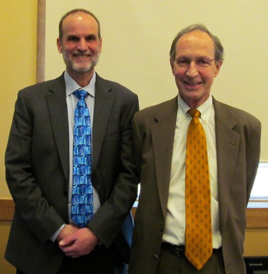
Caption: Bill Paddock, water attorney for the Rio Grande Water Users, right, directed questions for witness James Slattery, left, who testified about the groundwater model on Thursday./Courier photo by Ruth Heide


